Your land in ART.

Ducks Unlimited Canada (DUC) is offering Saskatchewan landowners access to a high-detail mapping product—the Ag Resource Tool (ART).

ART uses current satellite imagery to provide a clear, overhead view of your land and is widely recognized as a practical, reliable land-management tool. Maps can be customized to your needs, from basic imagery to detailed layouts showing fence lines, gates, water sources for livestock, and more.

These maps are a valuable reference for grazing and rotation planning, communicating with partners or managers, and planning future improvements and developments.

With ART, you can:

  • Accurately tabulate acres by land-cover type—such as annual crops, native grass, tame grass, and wetlands—so you can confidently manage each field.

  • Calculate stocking rates and plan rotations to support sustainable rangeland grazing.

  • Use clear, detailed maps to support day-to-day decisions and long-term planning.

DUC will provide a free, laminated map of your land holdings, customized to the level of detail you require (available in poster size). We’ll also contact you annually to offer map updates and share information on relevant producer events and programs in your area.

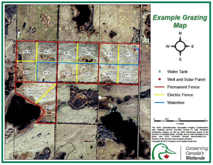
Basic or detailed, the choice is yours; customize for YOUR operation.

Contact Ducks Unlimited Canada to find out how you can see your land in ART.

By Phone: 1-866-252-3825